The Abstract Art All Around Us

Nature’s colors and patterns make for a vivid display

Study the science of art. Study the art of science. Develop your senses – especially, learn how to see. Realize that everything connects to everything else."
― Leonardo da Vinci
Hashem is called the “Master Artist.” And there’s nothing like Creation to prove it. But we don’t usually think of Hashem’s natural art as also being abstract and modern. These places — and pictures — prove otherwise.
The Menindee Lakes
New South wales, Australia
NO, this isn’t a slab of marble… It’s a satellite image of the Menindee Lakes — or what’s left of them. This chain of nine freshwater lakes was used by the Australian government to manage overflow from the nearby Darling River. In 2016, they were nearly full. Just a few years later, they were almost entirely dried up.
Because of extreme drought brought on by hot temperatures and not nearly enough rain, the water storage level of the lakes dropped to one percent and even stopped flowing in some parts of the Darling River. Millions of dead fish were discovered floating belly up in the river in January 2019, killed by the conditions in the water. It was a true low for the water system — and one that could easily be seen by monitoring satellite photos of the area over the years. But there’s good news in recent years: The lakes are filling back up.
As of August 2021, the largest lake, Lake Menindee, had already reached 90 percent capacity. And you can see the others, like drops of milk in the red desert. Animals are returning to the area. But that doesn’t mean the area is in the clear. Building and industry in the area leave the water system and its wildlife in danger. Seeing those “drops” out in the desert, one gets a perspective on just how fragile that ecosystem is.
The Yukon Delta
Alaska
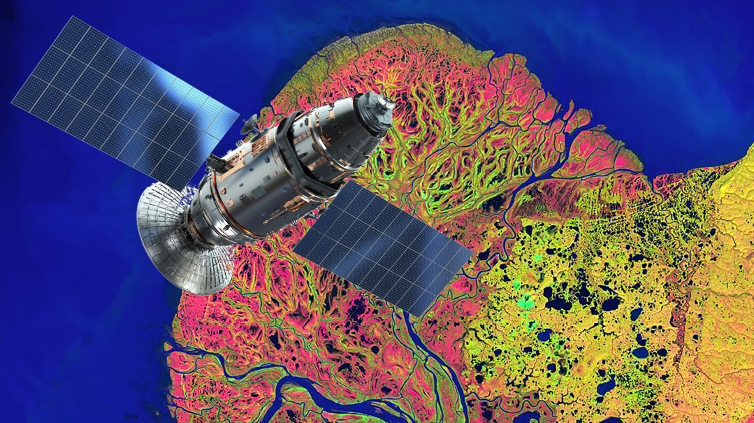
Who knew that early spring thaw could look so colorful and cool? This isn’t some piece of lettuce or an ink chromatography experiment under a microscope. It’s Alaska’s Yukon Delta. A delta is an area of low, flat land shaped like a triangle, where a river splits and spreads out into several branches before entering the sea. This delta, in southwestern Alaska, is one of the world’s largest. The Yukon Delta is particularly interesting because it’s a place where freshwater, saltwater, tundra, forest, and wetlands all meet. The Yukon River fans out into numerous waterways that flow into the Bering Sea — and that’s what we’re looking at here. The delta typically thaws around May or so — and when satellites snapped photos of the area last year, they captured the warming water diffusing into the colder water and remaining sea ice, creating this beautiful image.
But is it really this color? No. The satellites create “false-color images,” using reds, greens, and blues to reveal (or enhance) elements that would otherwise be invisible (or barely visible) to people. In other words, what you see is really happening and does look like that, but the colors make it so that we can see what’s actually going on, because otherwise our eyes wouldn’t detect it.
Images like this are captured by satellites using special instruments to measure factors like electromagnetic energy, infrared light, and other data. This tech helps reveal the landscape in a different and new way.
To us, the image just looks cool. But to scientists who know what to look for, pictures like this provide info on the distribution and health of plants in the area, water temps, environmental changes, and more.
The Salt Flats — Salar de Uyuni
Bolivia
Located at an elevation of 12,000 feet (FYI, that’s really high — the highest town in the United States is Alma, Colorado, located at 10,361 ft), Bolivia’s Salt Flats don’t usually look like much from space. Known as Salar de Uyuni, the area stretches almost 4,000 square miles across (that’s the size of Hawaii!). Normally, it shows up as a flat white expanse in satellite shots. In fact, it’s one of the places that’s actually used to calibrate satellite cameras. That’s because the bleak landscape is perfect for techs to make sure such cameras are accurately detecting what’s on the ground.
Tourists like to visit Salar de Uyuni because of the large numbers of flamingos that flock to the area — and to see the cute viscachas (rodents related to chinchillas). In the wet season (summer), rainfall collects on the salty crust of the flats, creating a cool mirror-like effect. But extreme weather does interesting things to the region. From November 2021 through January 2022, heavy rains changed the landscape into a swirl of colorful patterns — and this time the colors are real (not false-color images). Water runoff from the surrounding mountains, sediment and particles, and algae have changed the way the region looks. And high winds push the water and sediment around, creating this interesting marble pattern. Scientists won’t be calibrating their satellite cams there anytime soon.
The Great Salt Lake
Utah
Salt pans (aka salt flats) are flat expanses of ground found in deserts and other places where water evaporates, leaving salt and other minerals behind. Some are natural, others are manmade. Salt pans tend to be white and shimmery when photographed from above. But the salt pans of Utah’s Great Salt Lake include a kaleidoscope of colors, from almost red to pale green.
While the Great Salt Lake’s salt pans are manmade (developed to catch the salt and minerals of the lake), the colors are not. They’re created by the salt, bacteria, and algae in each holding area. The reddish ponds are the saltiest. The lake itself (here appearing bluish-green) contains some 4.5-4.9 billion tons of dissolved salt. The water is also rich in minerals like sulfate, magnesium, calcium, and potassium.
Does the Great Salt Like bring to mind another famous salty sea? Perhaps one that’s a little closer to “home” for you? Curious what the Dead Sea looks like from space? Check out this NASA snap of the Dead Sea’s salt pans.
Greenland’s Ice Sheet
This satellite image, snapped on August 21, 2021, reveals Greenland’s glacial ice melt, as light blue water flows across the ice and collects in slush. The darker blue areas are meltwater “lakes” up to 30 feet deep. The ice melt actually starts below the surface, so researchers can possibly hear it before they see it. It’s only once the ice melt turns into a flood that the snow and ice on the surface actually give way.
The Greenland Ice Sheet covers 650,000 square miles, almost the size of Alaska, the largest US state. It’s second in size only to the ice sheet in Antarctica. But the Greenland Ice Sheet is shrinking… and doing it too fast. Usually there’s some seasonal melt each year. But a heatwave last August left torrents of water flowing across the sheet, which is melting seven times faster than normal. And therein lies an even bigger problem: The faster the ice melts, the more it causes the rest of the ice to melt because of the conditions it creates.
This image is stirring not just for its beauty but for what it tells researchers, who say it reveals just how extensive the melt is.
Nature’s Fractal Geometry
Fractals are, simply defined, patterns that occur again and again at different scales and sizes. In a perfect mathematical fractal, the patterns go on infinitely: each pattern is made of smaller copies of itself, and those copies are made of smaller copies, and those are made of… well, you get the picture. If you would divide a fractal pattern into parts, you’d get a nearly identical copy as the first — just in a smaller version.
Fractals occur not just in (advanced) mathematics but also in nature. And the more you look for them, the more you’ll notice them in things from the structure of our lungs to the fanning of river deltas and the strike-shapes of lightning.
Here are some places to look for this form of Hashem’s abstract (and mathematical!) art in the world around you:
Leaf veins: the network of veins that move liquids through the inside of a leaf.
Snowflakes: the crystalline structure of ice repeats the six-fold symmetry of the snowflake several times.
Sycamore trees (and some other species): the trunk forks into two branches, which fork again, and then fork again, into smaller and smaller branches, and ultimately twigs.
Ammonite sutures: these marine cephalopods (a type of sea creature) build spiral-chambered shells. The walls between the chambers, called sutures, are complex fractal curves.
Ferns: demonstrate “self-similar set fractals,” which means their patterns can be easily mathematically generated and reproduced at any size.
Recognize these? Peacock feathers demonstrate fractal patterns.
This image of Romanesco broccoli was a finalist in the 2021 BigPicture Natural World Photography competition. The broccoli demonstrates fractal patterns and other mathematical principles.
The Supersized Dust Devils of Mars
“Dust devils” are whirling columns of air. When direct sunlight heats the ground and the air just above it, the warm air rises. As this warm air goes up, the cooler air above it sinks down. If there’s strong enough wind, these columns of warm-cold air begin to spin, and a “dust devil” is born. They can occur anywhere sunny and dry enough. Though they look kind of like tornadoes, they’re much smaller and weaker (and therefore less destructive) than twisters. But that’s on Earth, where they’re usually no bigger than a car and stretch up to a few hundred feet high. On Mars, dust devils are massive — like a mile wide and 12 miles tall.
On Mars, the dust devils leave scars (or trails). They’re picked up by the powerful camera on the Mars Reconnaissance Orbiter, as part of the High-Resolution Imaging Science Experiment, and passed along to us on Earth…
Indonesia’s Twin Volcanos
IF you didn’t know what you were looking at, you might think this image depicts two menacing and ominous eyes staring out at you. They aren’t eyes, but they are rather ominous: they’re two side-by-side volcanoes on the Indonesian island of Java, captured in a satellite image taken from over 250 miles above the planet by an astronaut on the International Space Station.
You’d think that when it comes to volcanoes, two are more dangerous than one. But as it turns out, the peaks of Sundoro and Sumbing — less than ten miles apart — are dormant. And scientists say they’re not necessarily double the trouble. Sundoro has had about six small eruptions in the past 300 years, while Sumbing had just one, in 1730.
While some “twin volcanoes” share a magma system beneath the surface and have two peaks, these twins are actually two separate neighboring volcanos. Nevertheless, they’re unlikely to erupt at the same time, and even if they would, the eruptions probably wouldn’t be large — at least that’s the hope of those living in the area. Until then, the “eyes” remain watchful.
(Originally featured in Mishpacha Jr., Issue 908)
Oops! We could not locate your form.


