Past and future unite in the ruins of ancient Shiloh
Photos: Menachem Kalish
Although I happen to live in the Biblical tribal portion of Naftali, up in Karmiel, the Shomron hills of Ephraim somehow call to me by name. Am Yisrael’s national story starts here, temporarily (over 2,500 years, but who’s counting?) falls apart here, and it is here, that the Torah tells us, will be the final stop before Mashiach and the House of Dovid will reign eternally ad ki yavo Shiloh: Shiloh, in the Mountains of Ephraim, the original capital of Eretz Yisrael, where the Mishkan stood for 369 years. The very present place where we can connect to our past and our future.
Back Roads
As we travel from Jerusalem, we pass through several checkpoints along the way as we cross over the “Green Line.” (Actually, we crossed it as soon as we passed the neighborhoods of Sanhedria Murchevet, Ramat Shlomo, and Ramot, but somehow that’s never too intimidating.) There are those tourists who get nervous traveling here, and I understand them. But somehow, knowing antisemitism is up about 30 percent around the world, in these parts — where Hashem tells us that He is watching us from the beginning of the year until the end, and with the added security of soldiers looking through the cocked guns all along the highways — I feel a bit more protected.
Along the way, we pass palace after palace — of Palestinian houses. Despite media claims, it’s clear that they seem to be living quite well over here, ensconced in villas abutted by opulent spiral staircases and decorative stone fountains.
We’re traveling on Highway 60, which is the modern path somewhat following the Derech Ha’Avos, the ancient north-south passage running through the land. It begins in Be’er Sheva in the south, moving north through Chevron and Beit Lechem, and even passing through Jerusalem near King George Street, continuing to Beit El, Shiloh, and Shechem, and all the way up to the lower Galil.
This is the pathway our ancestors traveled. Its route along the top of the central mountain range of Eretz Yisrael, and as the watershed dividing point of the range, made it easy to navigate — there were always many water cisterns along the way. Today we’re traveling to the ancient city of Shiloh by car for less than an hour — so we don’t really need to refill our water supply.
The authenticity of the site of ancient Shiloh (Tel Shiloh) isn’t hard to verify. It has been called Chirbat Siluein by the Arabs for centuries, and its location in Sefer Shoftim is precisely described: north of Beit El, toward the east of the road going to Shechem, and south of Levona. Shechem is due north of us and the Arab village of Labun maintains its ancient name.
The first archaeological excavations in the area began in the 1920s, but didn’t resume until well after the area was liberated by Israel after the 1967 Six Day War. In the early 1980s when Jews had begun to resettle the area (the nearby modern yishuv of Shiloh was established in 1979), extensive archeological digs were organized, revealing many ancient artifacts including coins, storage jars, and even carbonized wheat that was dated back to the period of the Mishkan.
Solving the Shidduch Crisis
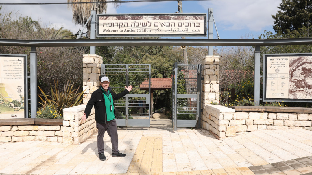
Entering the site of ancient Shiloh, it’s an inspiration to see how updated tourist sites have become in Israel. There is a state-of-the-art visitor center with a 3D hologram film of the Mishkan, as well as a tower in the center of the park with a film of the Tanach stories that took place here. We explore ancient Jewish burial caves that date back to the Second Beis Hamikdash period when Jews returned to live here, even as the original tribes that lived in these parts had been exiled and “lost” for several hundred years. Ancient olive presses and an impressive mosaic winepress that were certainly used to make oil and wine from the lush orchards and vineyards that still surround Shiloh.
These vineyards that surround us also recall the Chag Hashem of Shiloh, the day our Sages tell us was the happiest day on the Jewish calendar — Tu B’Av — when the Daughters of Israel would gather in the fields of Shiloh, dance together, and “catch” their husbands.
The idea of unity — of creating families and creating peace within Klal Yisrael — is a subtext of this ancient place. Shiloh, in the portion of Ephraim (the children of Yosef) is a bridge to resolution between the children of Leah and Rachel. Yosef unites us in Egypt when Yehudah sticks up for Binyamin (son of Rachel) and takes responsibility. Yaakov tells Yehudah prophetically that his scepter will be eternal only after “we come to Shiloh.” Yehoshua, from the tribe of Ephraim, is the one who brings Bnei Yisrael into the land, and it would seem that the Beis Hamikdash and Geulah are imminent.
But infighting ensued, culminating in the wake of the complicated and horrific story of Pilegesh B’Givah (Shoftim Chapter 19) and the devastating civil war that took place in its wake between the tribe of Binyamin and the other tribes. The tribes had taken an oath during the war that they would not allow their daughters to marry any Binyaminites, whose numbers were nearly decimated — and the first shidduch crisis of Klal Yisrael needed a quick solution. Only 600 men from Binyamin were left, and 200 of them remained without any girls to marry them. A decision was made that the girls would go out to the vineyards on their Tu B’Av festival, and the bochurim from Binyamin would be invited to “kidnap” them. Thus, the vow of not giving their daughters would technically still be kept and the crisis would be solved. From that point on, Tu B’Av became the holiday for shidduchim. After all, is there a greater simchah than resolving the shidduch crisis? And a greater unity than bringing the nation together in holy wedded matrimony?
Spot for Supplication
One of the most exciting modern discoveries on this ancient Tel is the site of the Mishkan. For many years archeologists searched within the city for the elusive site. It was only in 1980, during construction in the modern town of Shiloh, that the site was discovered. Tanach scholar Rabbi Yoel Bin Nun (whose brother Rav Elchanan, a rosh yeshivah, lives in Shiloh and served as the community’s rav for 40 years, from its inception until last year) described the euphoria he had when he realized where the site was. It seemed clear from the pesukim that when Eli HaKohein — who was in charge of the Mishkan at Shiloh — was told that the holy Aron HaBris (Ark of the Covenant) was lost in battle with the Plishtim and that his two sons were killed, he was sitting outside of the city, beyond the walls.
When the ancient Canaanite walls around the Tel were unearthed, Rabbi Bin Nun began his search on the northern side of the Tel and remarkably found a quarried-out flat plain that measured exactly 100 by 50 amos. Alongside it were remains of earthenware pots and jugs that date closely to the period when the Mishkan was destroyed and the Aron captured — 369 years after Bnei Yisrael entered Eretz Yisrael.
Walking past the Canaanite city wall, I think about its halachic significance. Because it dates to the era when Yehoshua Bin Nun brought Bnei Yisrael into the land, it means Shiloh was a walled city then, deriving its halachic status as a “walled city” for celebrating Purim. That’s why for Purim, the modern town of Shiloh reads the Megillah and fulfills the mitzvos of the day on both the 14th and 15th of Adar (both “regular” Purim and “walled-city” Purim).
When we arrive at the holy makom ha’Mishkan, we find the tefillah of Chanah posted here on the wall for visitors to recite as well as an additional tefillah for children. It was that broken-hearted silent prayer of this childless wife of Elkana who promised to dedicate her son to Hashem, that is the source of what a true heartfelt prayer should look like. So many women and singles come here to this holy place to daven that they, in the merit of Chanah have their tefillos answered to build a bayis ne’eman and to merit children that will be mekadesh Hashem as her son Shmuel HaNavi did.
From the ancient city we exit the site, stopping for a quick tefillah next to a pyramid-like structure outside the park that pilgrims throughout history — Jewish and gentile — have attributed to be the burial place of Eli HaKohein. There was a mosque here called the Kipt Hashechinah, built on the remains of a Byznatine church. Today many Jews come here to daven as well. We find a small painted blue corner with some candles and a well-used Tikkun Klali to aid us in our prayers there.
Where We Don’t Daven
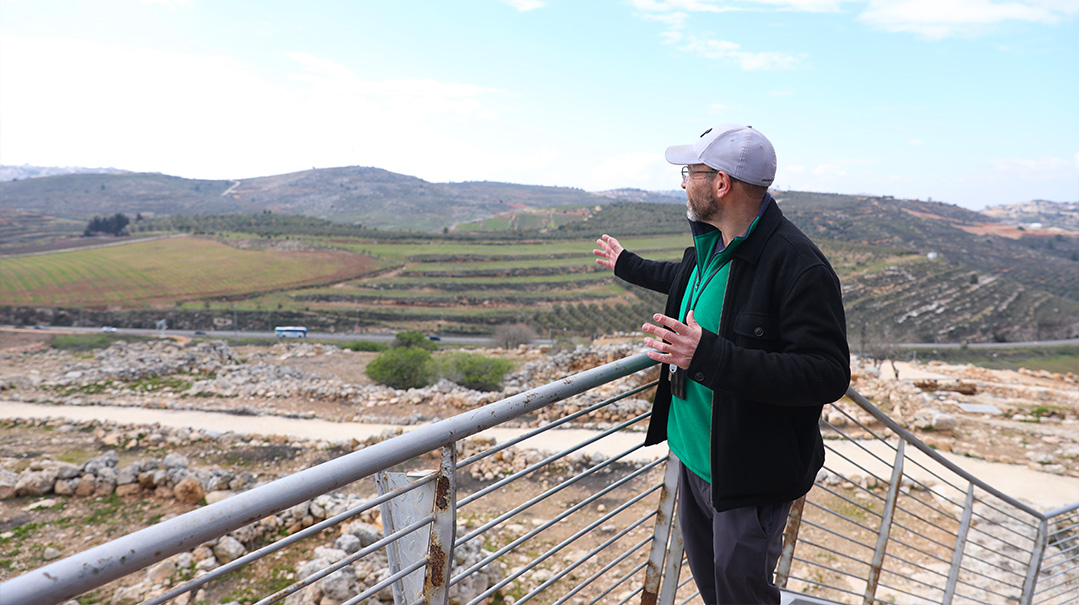
We continue our journey in this ancient region — not by being oleh regel, but via ATV — to visit some off-the-beaten-track sites with my friend Boaz of Shiloh ATV, a tourist service that gives rides throughout the area. Driving along Nachal Shiloh, the main water source for this area, we see ancient and modern water cisterns along the fields of trees that now cover this range of hills that were barren according to testimonies of the pilgrims who came here throughout the millenia. We drive up to the peak of one of these hills for a lookout point where we can see the two tall mountains of Har Gerizim and Har Eival in the distance — the first stop in the Jewish People’s entrance into Eretz Yisrael on the tenth of Nissan.
I asked Boaz to take us off the beaten track, to a place people rarely visit. It’s the ruins of what seemed to be a small chaan, or hostel, that the Arabs call Chirbat Jeraba, or Cha’an El Ouf. Yet at this site, which is about three kilometers west of Tel Shiloh, ancient remains of a Jewish settlement from the period of the Second Beis Hamikdash — and even underground tunnels from the period of the Bar Kochva revolt 65 years later — were discovered, along with wine and olive presses and a mikveh. Yet this is almost certainly the site of the “alternate” shul that we hope our ancestors didn’t daven in. For this it would seem to be the location of where Michah and the infamous idol he brought with him from Mitzrayim were stationed.
The Gemara in Sanhedrin tells us that Michah lived in a city called Gerev — which sure sounds like the Arab town Jeraba — and that it was three miles to the west of Shiloh. The smoke from the altar that Michah made would rise up and mingle with the smoke coming up from the Mishkan until the Jews were exiled from the land. This hilltop is right off the Shechem-Yerushalayim path, and Chazal tell us that Michah’s merit, despite his penchant for prohibited idol worship, was that he would provide food to the wayfarers who traveled along this ancient main highway.
Blessing in the Vineyards
Not far from here as well are the remains of the village of Tzreida, where Yeravam Ben Nevat, also from the tribe of Ephraim, lived. It is near here that he met Achiya HaShiloni (of Shiloh) and was told that he would lead Klal Yisrael, as Shlomo Hamelech’s kingdom would be divided because of the sins of idolatry that his wives brought into the land. Yeravam, though, was not satisfied with merely leading the tribes. He rebelled against Shlomo’s son Rechavam, splitting off ten tribes and building Israel’s first security fence while establishing an alternative Mikdash — one in Beit El and another in Tel Dan in the north — where Michah’s idol ended up after the tribe of Dan took it from Michah. And so, once again we find that the land of Ephraim in the heart of Eretz Yisrael is not only a place of unity, but of the division of Klal Yisrael as well.
Inspired by all the rich history, we head over to the local farm and vineyards of one of the original Shiloh settlers, my friend Era Rappaport. He moved to Eretz Yisrael from Brooklyn half a century ago and planted the first vineyards in these parts when Jews began to return here in 1979. He also served as Shiloh’s longtime mayor. His farm, Bikurei Shiloh, was inspired by the words of the Navi — to once again see fields and vineyards grow in the hills of the Shomron.
At the time he was a tour guide and shared his dream with one of his American tourists, yet he explained that the cost was too prohibitive for him to buy the vineyards and develop the land. The tourist called him back a few days later and told him that he had somehow come into some money that he thought he would never recover from a bad loan, and had even personally forgiven the debt. To his amazement, as soon as he returned to the States, the client had repaid his debt. Feeling it was a sign, he decided to be part of this mitzvah and thus Bikurei Shiloh was started.
This past shemittah year, Era saw the blessings first-hand once he began working the land after shemittah. Meanwhile, though, Arabs had been expanding and encroaching on the land, and Era knew the only way to hold onto his parcel was to work it. But after shemittah and no income, he was strapped.
Once again, it seems, Hashem was smiling down upon this gibor chayil. The next day, Era received a phone call from a former client: He wanted to share in the shemittah mitzvah by having a parcel of land in Eretz Yisrael that would be worked and planted for the upcoming cycle of six years and would lay fallow on the seventh. On one hand, Era couldn’t believe his good fortune, but on the other hand, he informed his new partner that chances were slim that they’d even be able to plant this coming year, as there were no saplings to be found by either of the two sole distributors in Israel. The client assured him that he should start the work and Hashem would continue to provide. And the very next day, Era received a phone call from the distributor that exactly 500 saplings — the exact amount he needed — had become available as another client canceled due to legal issues.
Today, Bikurei Shiloh offers family activities as well as an opportunity to buy and plant trees and pick the fruit, thus fulfilling the mitzvah of settling the land, as every tree planted here is keeping the land in Jewish hands.
On our tractor/wagon ride out to the future orchards that will grow here, the fields are lined with red kalanit (anemone) flowers that have just begun to blossom. It looks almost as if Hashem sent us a red royal carpet of flowers as we walk down the aisle to the fields. We pass a 2,000-year-old water cistern that the Arabs still use to give water to their animals. Era tells us how he once came upon a similar cistern in the area and found four padlocks on it. Wondering why it was necessary to have four padlocks on one cistern, he soon got his answer when four Arab cars pulled up and each came out with their own key to one of the locks. It seems that, as the throwback to the times of Yaakov Avinu where there was one large stone covering the well that they would all have to remove, they simplified the process with four padlocks. Some things never change.
Land of the Living
Our next stop was a visit the hilltop farm of Chavat Nachal Shiloh that was established two years ago by Michoel and Tehilla Shemla and their two young children. Michoel, who lived in Givat Ha’Roeh, a small settlement a few hills over from here, lost his leg fighting in Gaza in 2014. After that, while he was homebound, he saw how the Arabs were illegally taking over dunams and dunams of land and planting without anyone stopping them. The loss of his leg and the helplessness he felt motivated him to do something for Eretz Yisrael. With his wife’s encouragement. they moved out here to this hilltop and decided to raise sheep.
There are two ways one can hold land under the ancient Ottoman law that still applies and is recognized by the locals. The first is by planting trees and the second is by raising sheep and allotting land for grazing. With his small flock of 50 sheep, Michoel is already in possession of hundreds of dunams that is considered his sole grazing area, and which the Arabs will not infringe upon. Michoel is out with the sheep when we arrive, but we do get a chance to look at their very primitive living quarters, with hand-pumped, rationed water and generators that don’t always work.
Our final stop is to daven in the Mishkan itself. Okay, I’m not that good of a tour guide. I can’t take you to the actual Mishkan, but a close second is the main shul in the modern yishuv of Shiloh — built to look like the Mishkan, with the very same measurements. Pulling up to the building we are taken by the magnificent structure that overlooks the ancient Tel. The walls look like the kerashim pillars and its multi-tiered roof is shaped with colorful layers of what is made to look like the animal-skin yerios, while the ramp that leads up to the ladies’ section is built like the copper Mizbeiach with four horns on the corners. Walking into the building, we pass by the copper sink where the locals who come to daven wash their hands. In the shul we are taken by the bimah, which is shaped like the Shulchan, its drawers being the Lechem Hapanim. The aron kodesh with Keruvim and its permanent poles are separated by pillars that model the Heichal, with the amud for the chazzan as the golden Mizbeiach Ha’ketores.
As the sun sets over our heads, my thoughts turn to the Gemara in Zevachim, that tells us how, after the Mishkan was destroyed, Jews would pass by here and remember the sacrifices that would be brought. It was that longing and national memory that eventually brought us to merit the Beis Hamikdash. Our longing for a rebuilt Yerushalayim hasn’t waned in 2,000 years, and the hills of Ephraim are once again filled with the tefillos of Am Yisrael. We’re told that Mashiach is meant to come in the year of Motzaei Shevi’is, the year following shemittah. As we united around the techeiles of Mordechai, the descendant of Shaul, on Purim, and as we enter the month of Geulah of Nissan, may we see it all before our eyes.